
Table of contents:
Faster loading of the home page
Introduction of .E57 point cloud support
New “Average point” Automation
Linking to a specific photo annotation
Improved vertex editing in measurement tools for the “Telecom” site type
Saving user-defined limit box values
Added marking for shared layers in cross-sections
Improvements
Faster loading of the home page
Improvements have been made to the handling of queries such as organization management, site management, and changing the currently displayed project from the top interactive bar. As a result, the portal now runs more smoothly.
Introduction of .E57 point cloud support
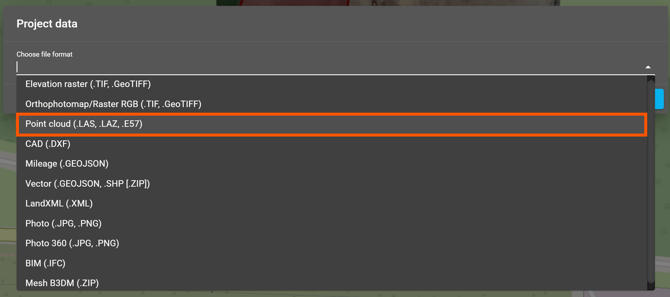
Support for the .E57 format has been introduced, allowing files of this type to be imported directly into the portal. This information is also displayed in the data upload panel.
New “Average point” Automation
A new automation for determining the midpoint based on the arithmetic mean of the coordinates of selected pins has been introduced for the Telecom site type (at least 3 point measurements are required to use this function). The tool is available in the Automations tile.
Linking to a specific photo annotation
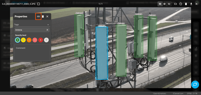
It is now possible to copy direct links to annotations added to photos. Clicking a shared link takes the user directly to the view of the specific annotation. This improvement streamlines communication and information sharing within inspection workflows.
Improved vertex editing in measurement tools for the “Telecom” site type
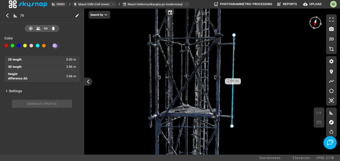
Vertex markers have been introduced for measurement tools dedicated to the “Telecom” site type. After selecting a completed measurement, the end points are displayed as clear dots, significantly improving vertex visibility and making them easier to edit.
Saving user-defined limit box values
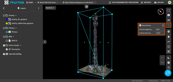
A function for saving limit box settings (the bounding area) has been introduced for the “Telecom” site type. This makes it possible to preserve a previously defined 3D data display range. The area is saved per dataset.
Imperial unit support
Support for the imperial system has been introduced in measurement tools for projections in feet. Measurement results are now displayed in the following units: distance (ft), area (ft²), and volume (yd³).
3D Gaussian Splatting
Support for 3D Gaussian Splatting data visualization has been introduced. This solution provides a more natural appearance of displayed objects. The feature is currently available in beta — users interested in implementing it in their projects are encouraged to contact our team directly at app@skysnap.com.
Changes
Vector data occlusion by mesh
The 3D project view has been improved with depth support for vector data. Vector objects located behind the mesh model are now naturally occluded.
Added marking for shared layers in cross-sections
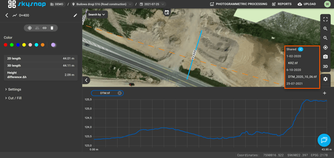
A visual distinction has been introduced for shared elevation rasters uploaded at the site level. They are now displayed at the very top of the selection list and marked with a blue icon, allowing for quick identification when creating cross-sections.
Filtering annotations with no assigned tag
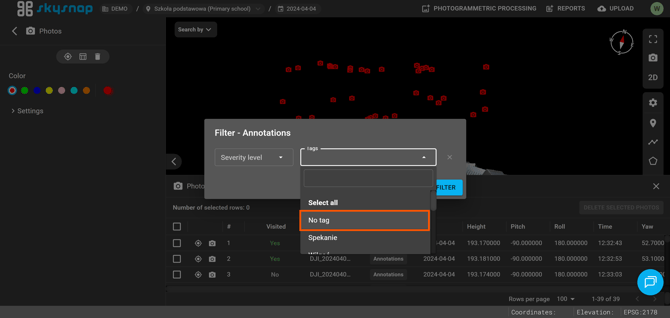
It is now possible to filter annotations based on the absence of assigned tags. This feature makes it easier to quickly identify photos that still require tagging.
Fixes in site and organization user tables
The readability of user invitation forms has been improved by enlarging the email address input field. In addition, a mechanism for automatically suggesting the last selected role has been introduced. This speeds up the process of assigning permissions.