
Table of contents:
Performance and portal loading speed optimization
Default columns in the Photos table
Improved handling of CAD and BIM (.IFC) files
Displaying deleted projects via URL
Automatic centering of the 3D view to mesh files
Improvements
All operations related to managing organizations and their users, as well as sites and their users, are now executed faster. The cross-section generation process has also been accelerated.
Geochat behaviour notice
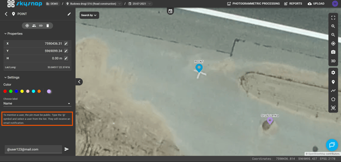
A notice has been introduced to remind users to set the appropriate pin status (public measurement) and to use the “@” symbol in the message body to mention a selected portal user. This information significantly improves communication between users.
Default columns in the Photos table
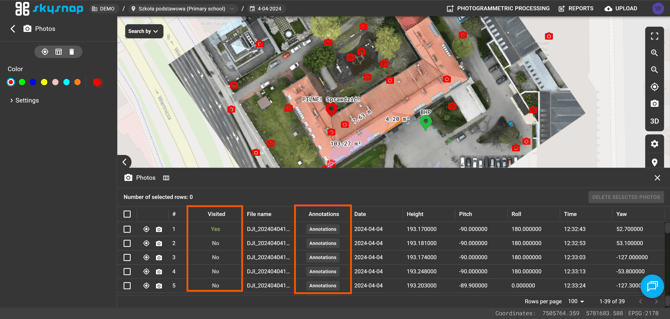
The “Annotations” and “Reviewed” columns are now visible by default in the Photos table. This change significantly streamlines inspections by enabling quick verification of the review status of photos and an immediate overview of the annotations added to them.
Displaying deleted projects via URL
Issues related to accessing deleted projects via direct URL have been fixed — when attempting such access, a message is now displayed informing the user that the given project was not found in the list of projects for the site.

Automatic centering of the 3D view to mesh files
Automatic centering of the 3D view to the uploaded mesh model has been introduced for cases where no point cloud is available in the project. This change eliminates the need to manually use the centering button in the layer properties. In projects that contain both a point cloud and a mesh, the point cloud has priority for automatic centering.
Improved annotation filtering in the Photos table
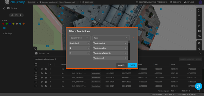
The photo table filtering mechanism has been improved, allowing selection of multiple annotation importance levels at the same time, as well as enabling filtering of tags without an assigned importance level.
Map view optimization
Fixes have been introduced for refreshing the map view after changes to site settings, project settings, and file names, as well as when attempting to select this data in function selection fields.